

For a Transport Fever 3 Deutschland Karte, start with Germany - Mittellandkanal by Alkolique if you want a northern German corridor rather than a miniature of the entire country. The creator describes an 11 × 22 km Temperate map, using the Very Large, 1:2 format, stretching from Magdeburg to Hanover. Hanover, Braunschweig, and Magdeburg form its main urban anchors, with roughly fifty smaller towns and villages between them.
Choose this map for a project built around inland waterways, regional distribution, and a long rail corridor. Install the exact listing, load the map, and inspect its actual towns, water access, and industries before designing your first line. The real regional setting does not guarantee a profitable starting route or a finished railway network.
Identify the exact Germany map
Open the Germany - Mittellandkanal listing to check its current files and platform support.
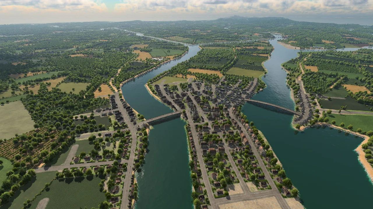
The creator's regional map preview. Inspect the loaded towns and waterways before choosing a route.
The relevant Mod.io listing is Germany - Mittellandkanal, creator Alkolique, mod ID 6289205. Matching the creator and ID helps distinguish this map from other German maps, similarly named uploads, or maps made for Transport Fever 2.
The description places the project across Lower Saxony and Saxony-Anhalt, following the canal region between Hanover and Magdeburg. Braunschweig is the third major city named in the description. Treat those names as the regional frame, not as a promise that every German city or railway service appears on the map.
This distinction matters when planning a project. A national recreation, a city-focused map, and a long canal corridor place different demands on route design. Here, the elongated shape gives you room for transport along the main axis and smaller connections branching off it. If your priority is Berlin, Munich, or a complete Germany-wide network, inspect another listing rather than assuming those places are included.
Check that the entry belongs to Transport Fever 3. A screenshot containing German trains alone is insufficient identification: vehicle mods and older game maps can look similar in a search result. The game, map name, author, and listing ID together provide a much clearer match.
Check dimensions and platform files before installing
The creator's published description gives these practical starting details:
| Property | Published value | What it means for your project |
|---|---|---|
| Climate | Temperate | Use the map as a Temperate regional project |
| Dimensions | 11 × 22 km | Plan around a long corridor rather than a square footprint |
| Format | Very Large, 1:2 | Check the selected map entry rather than recreating a random seed |
| Main cities | Hanover, Braunschweig, Magdeburg | Inspect their actual locations after loading |
| Smaller settlements | Roughly fifty | Expect many possible feeder connections, not automatic demand on every route |
| Terrain source | Processed Copernicus 10 m DSM | The author has adapted the terrain for the map |
The file listing captured for this guide shows a v1.0 file for Windows, Mac, and Linux, approximately 116.18 MB, with no dependencies listed. Check the current listing before downloading: a later upload can change the version or its files.
The inspected entry does not list PlayStation or Xbox files. That is a boundary of this map's available file evidence, not proof that every Germany map is unavailable on consoles. Console users should check the actual platform filter and file support of the entry they intend to use. Do not assume that general game support for mods makes every individual upload compatible.
Load the map before planning a network
Open the matching listing in the game's Mod Hub or the supported installation route for your platform. Confirm the file has finished downloading before looking for the installed map. A subscribed entry and a locally available file are different states.
When starting the project, choose the installed map entry rather than expecting a seed to reproduce it. A random map seed belongs to procedural generation; it does not reproduce an author's imported terrain, named settlements, and hand-adjusted region. If you cannot find the map, first check the download status, selected game, and installed file instead of repeatedly changing the seed.
After loading, pause and inspect the map. Find the three main cities, follow the canal through the region, and look for the smaller settlements you might serve. Then inspect industries and their cargo requirements in the actual world. The description establishes the region and intended transport themes but does not provide a complete starting industry plan.
Use a separate initial save for this inspection. That gives you a known starting point for your own building experiments. It also makes it easier to compare a canal-focused layout with a rail-focused layout without confusing the original map with later terrain and infrastructure changes.
Understand the processed terrain
The author states that the terrain was built from Copernicus 10 m DSM data and then processed extensively. The description mentions flattening lowlands and adjusting river margins. Those changes are part of making the terrain useful for this transport project.
A digital surface model and a finished playable map are different outputs. The source resolution does not mean every visible game contour is an untouched ten-metre measurement. Equally, the imported region does not imply that every canal bank, industrial plot, or rail alignment is ready for your preferred construction.
Inspect terrain where a line actually needs to go. A corridor can appear flat from a high camera position while a particular station approach or shoreline still needs work. Check the relevant local slope and water access before committing to an expensive terminal or long approach.
If you want to create a different German region, this map is a reference for what a processed terrain project can become. It is not a built-in downloader for arbitrary real-world regions. For a separate terrain import, use the Heightmap Generator guide to understand the game's image and import requirements.
Plan a canal freight project around actual water access
The creator presents inland waterway freight as one of the map's main uses. Begin by checking which industries and consumers can support that idea in the world you loaded. A canal passing near a facility does not by itself establish a cargo connection.
For each proposed ship route, inspect the origin, destination, cargo class, and shore access. A cargo harbor needs a workable connection to land-side loading or delivery as well as navigable water for the ship. Decide whether the ship carries cargo directly to a consumer's catchment or to a transfer point that still needs a truck or train connection.
Build one complete corridor before adding branches. For example, identify a producing facility, a receiving facility with actual demand, and a compatible cargo path between them. The particular commodity depends on the map's real industries; do not pick one just because it appears in an attractive screenshot.
At a busy harbor, inspect landing assignments as well as the number of landings. Multiple lines can still compete for the same assigned landing. The Oil Rig to Port guide explains the harbor connection and assignment checks; apply those checks to your canal terminals rather than treating extra harbor capacity as automatically used.
Separate the long rail corridor from local feeders
The description also highlights high-speed railway possibilities. That is an invitation to build a regional project, not an assertion that a named train service or ready-made high-speed route exists in the download.
Start with the main cities' actual positions and access needs. Consider where a through line would enter and leave each station, then keep room for local feeder routes that bring passengers to it. A visually direct railway can still provide weak service if its stations are inconveniently placed relative to the towns.
The elongated map shape encourages a long axis, but it does not require every train to stop at every settlement. You can plan a through corridor and smaller connecting services as separate roles. First establish the stops that have a clear purpose; add intermediate connections when the surrounding towns justify them.
Avoid deciding the entire network from the map preview alone. Zoom in on station approaches, river crossings, and town edges. A short inspection can reveal whether your preferred alignment creates awkward junctions or cuts through space you need for later freight access. The correct first route depends on your project goals and the loaded world, not on a universal Germany-map prescription.
Choose an economy project or a scenic recreation
Decide what you want the save to accomplish. An economy-focused project needs useful cargo and passenger deliveries with manageable costs. A scenic recreation can prioritize visual corridors and recognizable regional settings. Both can use the same terrain, but they should not be evaluated with the same success measure.
For an economy project, choose a modest first connection with a complete producer-to-consumer path. Check the map's industries, required input, output destination, and vehicle compatibility. Expand after the initial route actually delivers cargo or passengers, rather than after its track looks complete.
For a scenic project, use the regional anchors to choose your focal area. A canal-side industrial scene, a major-city rail approach, and a rural feeder corridor are all narrower projects than rebuilding the entire rectangle immediately. Concentrating on one part makes it easier to keep terrain, roads, stations, and landscaping coherent.
Vehicle add-ons are a separate decision. The map's German setting does not establish that a particular locomotive or rolling-stock pack is included. Check a vehicle listing and its dependencies independently. Keep the map download and the additional visual assets distinct so that a missing train mod does not look like a missing map file.
Troubleshoot a missing map or an unsuitable starting world
Use the failed stage to choose the next check:
| Symptom | Check first | Why it matters |
|---|---|---|
| Search finds a similar name | Game, creator, and ID 6289205 | Older maps and unrelated uploads can share regional terms |
| Subscription exists but map is absent | Finished download and available platform file | A subscription is not proof of an installed usable file |
| Random generation looks different | Whether you selected the authored map | A seed cannot reproduce the imported project |
| Intended canal route cannot operate | Water access, harbor connection, and actual cargo demand | Geography alone does not form a delivery chain |
| Planned train has no useful traffic | Town access and connecting services | A long railway needs passengers reaching its stations |
| A new project feels too large | A smaller regional objective within this map | You can build one corridor without developing every town immediately |
If loading fails after adding other mods, distinguish the base map from those additions. Check which items the save actually requires and preserve the original save while investigating. The inspected map lists no dependencies, but your expanded save can acquire dependencies through the vehicles, stations, or other mods you add later.
Record the map entry, file version, platform, and failing stage when asking for help. That information is more useful than a report that a “Germany map does not work,” especially when multiple maps and game versions appear in search results.
Related guides
Use Maps to compare different authored projects, Map Size to choose a practical footprint, and Heightmap Generator when preparing your own terrain import.